Kings Canyon - Watarrka National Park
Accommodation—Maps—The Rim Walk—Kings Canyon Pictures
Kings Canyon is the biggest attraction inside Watarrka National Park, so much so that few tourists know the real name of the park.
They often call it Kings Canyon National Park.
The park protects the rugged and scenic George Gill Range.
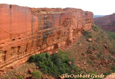
This range contains a massive gorge, with red sandstone walls that rise over 100 metres to a plateau of rocky domes and other sandstone formations.
Walks lead along the canyon floor as well as up to the rim and around the full length of the canyon.
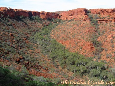
Many of my readers name the Rim Walk as the highlight of their trip to central Australia.
I don't quite see it that way, but any experiences that I rate even better require a 4WD, bushcamping and going on long wilderness hikes, or simply a lot more time than the average tourist has available.
If you only have a week to spend in the Red Centre, are stuck with a 2WD and don't really want to hike all day/overnight, then this may well end up being your number one memory, too.
The Canyon Rim Walk is certainly one of the best and most varied walks you can do in central Australia.
Where is Kings Canyon?
Watarrka National Park is in the Northern Territory of Australia. It lies south west of Alice Springs, in comfortable driving distance from Uluru/Ayers Rock.
Getting From Alice Springs To Kings Canyon
You can get to Kings Canyon from Alice Springs by 2WD. The distance is 474 km along the Stuart Highway, Lasseter Highway and Luritja Road, all fully sealed.
If you have a 4WD you can access Watarrka National Park via the Mereenie Loop Road, a short cut from the West MacDonnell Ranges to Kings Canyon and Uluru. Saves you a lot of backtracking and it's a very scenic drive to boot. (The distance from Kings Canyon to Alice Springs going that way is 357 km).
Getting from Ayers Rock/Uluru to Kings Canyon
To get to Kings Canyon from Ayers Rock/Uluru backtrack about 100 km on the Lasseter Highway and then turn onto the Luritja Road. The whole distance between Ayers Rock and Kings Canyon is 310 km, all fully sealed.
Kings Canyon tours are part of most three day or longer Uluru tour packages. You can find any style, the luxury tours in big airconditioned coaches or the more adventure style camping tours.
Kings Canyon Map
You can download and print the official fact sheet for Watarrka National park here (PDF).
It has a map of the whole area (inlcuding Uluru and Alice Springs) as well as a map of Kings Canyon National Park.
Kings Canyon Accommodation
Accommodation and a caravan park/camping is available at Kings Canyon Resort (only a few km from the canyon itself) or at Kings Creek Station (on the national park border, about 40 km from the canyon itself).
At the Voyages owned Kings Canyon Resort (that's the same company that owns the Ayers Rock Resort) you find everything from powered sites for caravans and unpowered tent sites, over budget bunkhouse accommodation and standard hotel rooms to their deluxe "spa rooms".
Kings Creek Station also has a campground and accommodation in safari style tents/cabins. (They are made from canvas but have a steel frame and solid floors, plus light and power, and shared facilities).
(The luxury outfit APT - Australia Pacific Touring - also maintains permanent facilities nearby, the "Kings Canyon Wilderness Lodge". It is mostly for their touring clients, but also accessible to self drive travellers if you book ahead.)
Kings Canyon Walks
The two most popular walks in the park are the short, easy stroll along the canyon floor and the much longer, in parts strenuous but very, very rewarding walk up to and along the canyon rim.
Kings Creek Walk - 2.6 km return /1 hr
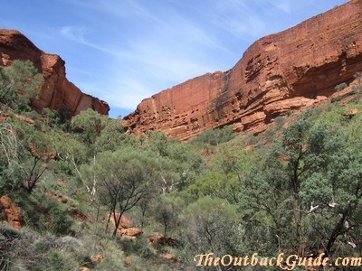
The first part of this easy stroll is accessible by wheelchair. The walk follows the canyon floor for a bit and has some signs and displays explaining the vegetation on the canyon floor. It leads to a lookout point from where you have nice views of the towering walls.
Kings Canyon Rim Walk - 6 km loop/3-4 hr
This is the real thing, the walk that everyone raves about. It requires an average level of fitness. I can't find anything hard about it, but I guess it does take a few hours, and there is that initial steep climb to get up tp the rim...
The path is a lot less steep where it comes down again on the other side, but you are only allowed to follow the walk in a clockwise direction. So there is no avoiding the steep climb...
It's not difficult at all, there are steps where necessary. (About 500 of them...) Just start early and take your time. If you are out of breath just pretend to admire the views. They are impressive after all!
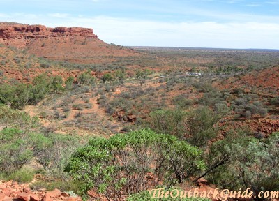
Once you reach the rim it's easy. You initially follow the northern rim on a flat path over weathered and flaky sandstone, with great views into the canyon and to the opposite wall.
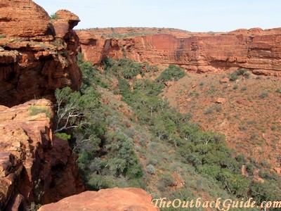
At the top end of the canyon the ground becomes more uneven. As you follow the walk around you find yourself between the weathered sandstone domes called "The Lost City".
There is also an opportunity to descend into a very sheltered valley with a permanent water hole, called "The Garden of Eden".
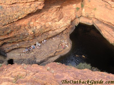
You really should not swim here for environmental reasons, but everybody does anyway...
I find this part of the walk is the most scenic, up and down and up again through same narrow gaps and rugged valleys... (There are boardwalks and stairs for the steep sections.)
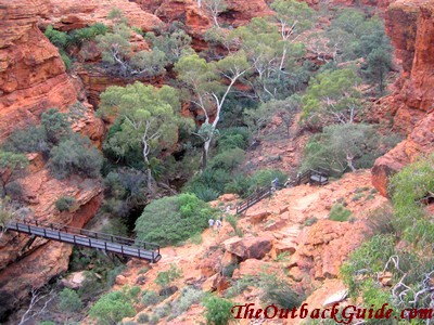
Others consider the views from the southern, second half of the walk towards the northern walls the most spectacular part of the walk...
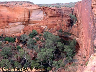
It certainly is a very, very varied walk. The scenery changes all the time, and each part of it is impressive.
Take plenty of water and plenty of time!
Other Walks
Kathleen Springs Walk - 2.6 km return/1.5 hr
An easy (albeit open and sunny) stroll to a permanent, spring fed waterhole, starting about 7 km from the Kings Canyon National Park entrance. The signs and displays along the way explain a bit about how Aboriginals used the area and also about the history of the early settlers. (There are remnants of old cattle yards and other signs of the early cattle industry.)
Giles Track - 22 km/2 days
This is an overnight walk for experienced bushwalkers only. It connects Kathleen Springs and the Rim Walk, following the top of the ranges. I haven't done it yet but look forward to doing it next time I'm down there.
Kings Canyon Tours
I should also mention that there is a range of guided activities as well. The Kings Canyon Resort offers tours similar to the way they do at Uluru. For example the Sounds of Silence becomes the Sounds of Firelight dinner...
They won't carry you up to the rim, but they do transfer you from the resort in an airconditioned luxury coach and guide you on the Rim Walk, and if you really don't want to exert yourself at all, you can do a helicopter flight from Kings Creek Station instead.
Kings Creek Station also offers quad bike rides and camel rides on their land.
Read about other National Parks in Australia
Australian National Parks Site Map
Return to Outback Australia Travel Guide home page


